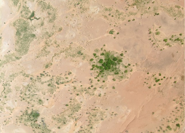
The mystery of increased runoff in the Central Sahel is better understood
The increase in runoff in the central Sahel since the onset of the drought that affected all of West Africa between 1970 and 1995 is a well-known phenomenon, but an intriguing one, since, at first glance, increased runoff and a rainfall deficit seem contradictory. This phenomenon persists today, with more frequent flooding during the rainy season, a local increase in water resources (pools, groundwater), and a greening of the region since the 1980s. How can this phenomenon be explained? Previous studies point to land clearing (for agriculture and wood energy) observed during the same period. Indeed, in this region, a reduction in vegetation cover often leads to soil crusting, which makes the soil less permeable and promotes runoff and erosion. But this hypothesis is not sufficient: Why are pastoral areas (with little cultivation) also affected? Why does runoff persist despite reforestation? Why isn’t this increase also observed further south (in the Sudanese zone)? A new study published by scientists from CNRS Terre & Univers, among others, proposes an original analytical framework to provide a unified description of all the hydrological changes observed since 1950.
The study is based on an observation: in the central Sahel, the hydrological conditions that existed before the drought did not return after it ended. This behavior, well known in systems dynamics, suggests a shift in the operating regime.
The researchers hypothesized that this change results from a transition between two alternative stable states, triggered by the drought. By analyzing observations available since the 1950s, they identified a gradual shift in the relationship between runoff and annual rainfall in the Sahel beginning at the peak of the drought. This shift, which precisely characterizes the regime change, is not observed in the Sudanese basins.
Read more on the CNRS Terre & Univers website.
Contacts GET: Manuela Grippa, Laurent Kergoat, Eric Mougin