Détection des marées dans la Garonne à partir de données GNSS
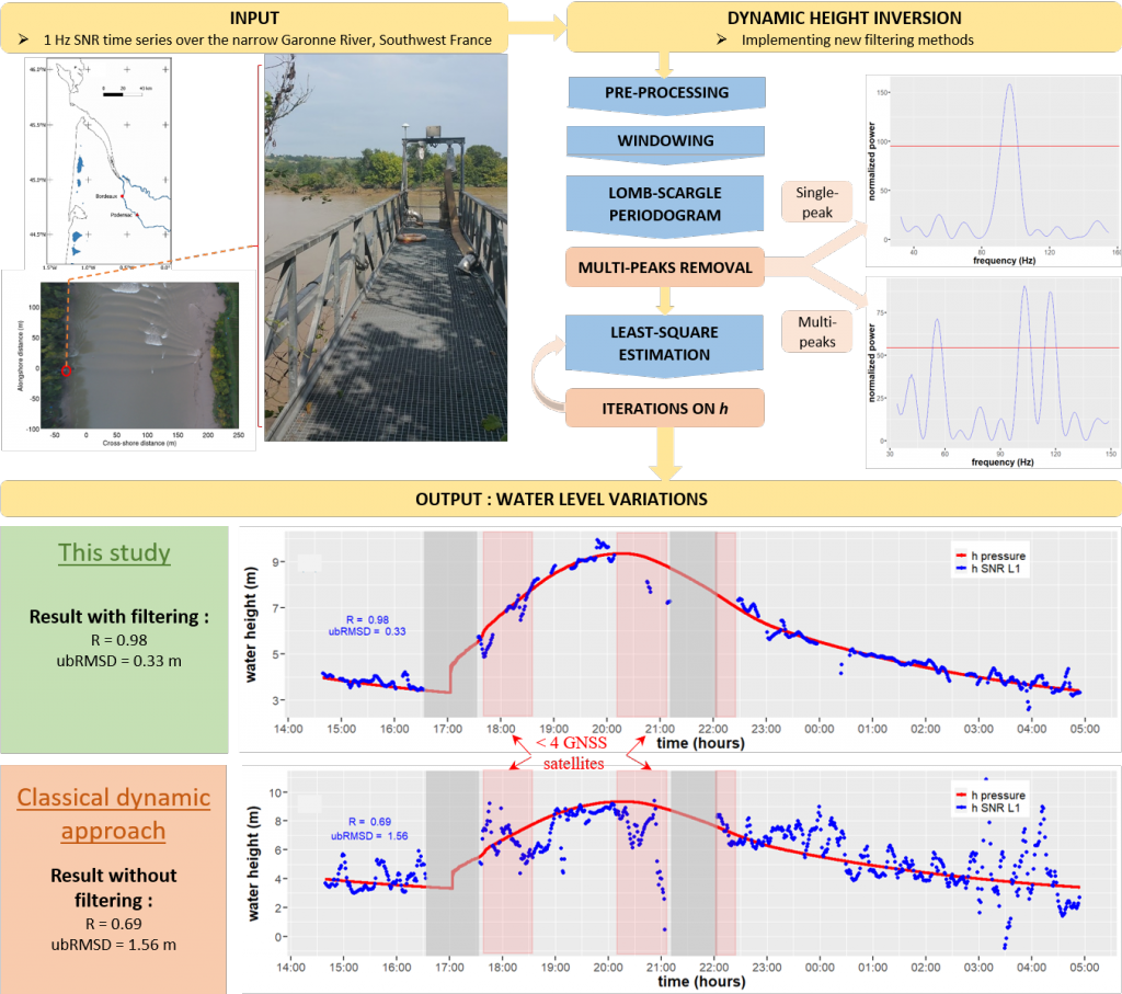
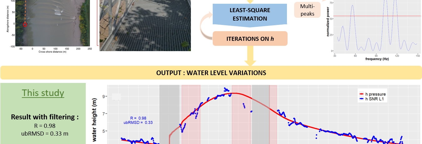
Signal-to-noise ratio (SNR) time series acquired by a geodetic antenna were analyzed to retrieve water heights during asymmetric tides on a narrow river, using the Interference Pattern Technique (IPT) from Global Navigation Satellite System Reflectometry (GNSS-R). The dynamic SNR method was selected as the elevation rate of the reflecting surface during rising tide is high in the Garonne River macro tidal conditions. A new process was developed to filter out the noise introduced by the environmental conditions on the reflected signal: the narrowness of the river compared to the size of the Fresnel areas, the presence of vegetation on the river banks, and the presence of boats causing multiple reflections. It is composed of the removal of multi-peaks in the Lomb-Scargle Periodogram (LSP) output and an iterative least square estimation (LSE) of the output heights. The evaluation of the results is performed against pressure derived water heights. The best results are obtained using all GNSS bands (L1, L2, and L5) simultaneously: R = 0.99, ubRMSD = 0.31 m. We show that the quality of the retrieved heights is consistent whatever the vertical velocity of the reflecting surface and is highly dependent on the number of satellites in visibility. The sampling of our solution is 1 minute with a 5-minute moving window, and no tide models or fit is used in the inversion process. This highlights the potential of the dynamic SNR method to detect and monitor extreme events with GNSS-R, including those affecting inland waters such as flash floods.