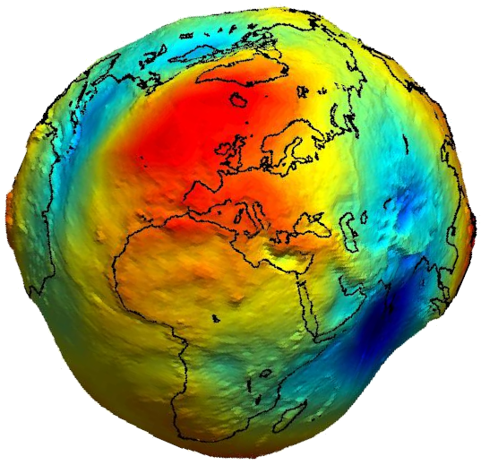

Implication dans les services internationaux de l’IAG
L’Union internationale de géodésie et de géophysique (IUGG) a pour objectifs la promotion et la coordination des études physiques, chimiques et mathématiques de la Terre et de son environnement dans l’espace. L’Union est une fédération de huit Associations semi-autonomes, chacune responsable d’une gamme spécifique de sujets ou de thèmes. Ces Associations englobent des études scientifiques sur :
- forme de la Terre, ses champs gravitationnels et magnétiques,
- dynamique de la Terre dans son ensemble et de ses éléments constitutifs,
- structure interne, la composition et la tectonique de la Terre,
- volcanisme et la formation rocheuse ; la génération de magmas,
- cycle hydrologique, y compris la neige et la glace,
- aspects physiques des océans, de l’atmosphère, de l’ionosphère,
- magnétosphère et les relations Soleil-Terre,
- des problèmes analogues associés à la Lune et à d’autres planètes.
Parmi les huit Associations de l’IUGG, l’International Association of Geodesy (IAG) a pour mission le développement de la Géodésie (recherche, enseignement, collecte et interprétation des données, développements instrumentaux, etc.).
Au centre est la recherche, la promotion et la fourniture de différentes représentations de la Terre (et des planètes) : la figure, la rotation et le champ de gravité variable, ceci avec un accent plus marqué sur les effets des changements globaux. Cela comprend 4 Commissions qui s’occupent de : i) l’établissement des systèmes de références, ii) le suivi de la rotation de la Terre et iii) de celui du champ de gravité, iv) les déformations de la surface terrestre incluant les océans et les glaces.
L’IAG doit initier et promouvoir la coopération internationale, le savoir et l’échange au cours d’ateliers de symposiums, d’écoles d’été et de publications. Afin d’obtenir les meilleurs résultats possibles à propos de l’Observation de la Terre et des changements globaux, des Services internationaux ont été développés (14 au total) en tenant compte des grands thèmes (Commissions) et des techniques d’observation.

The International GNSS Service (IGS)
L’IGS est un service de l’IAG qui comme mission fournir de données et de produits GNSS de haute qualité en soutien à l’ITRF (International Terrestrial Reference Frame), à l’observation de la Terre, au positionnement, à la navigation, au temps et à toute application utile à la communauté scientifique et à la société. Dans ce cadre, les membres CNES et CNAP de notre équipe constituent avec l’entreprise CLS (Collecte Localisation Satellite), un centre d’analyse de l’IGS.

The International Laser Ranging Service (ILRS)
The Analysis Center is regularly computing the solutions of station coordinates, geodetic satellites and Moon orbits, and Earth Orientation Parameters (EOP). It is based on a list of purely geodetic satellites as: LAGEOS (6000 km), ETALON and LARES.
This AC is included in the ANO-1 (‘’Métrologie de l’espace et du temps’’) of INSU/CNRS structure for Services.

The International DORIS Service (IDS)
The Doppler Orbitography and Radiopositioning Integrated by Satellite (DORIS) is a tracking technique based on a one-way ground to space Doppler link. For Low Earth Orbit (LEO) satellites, DORIS shows a robust capability in terms of data coverage and availability, due to a wide and well-distributed ground network, where data are made available by IDS
During the period 2019-2023, the DORIS community worked for improving the system (technology, models, data analysis): antenna, performance of Precise Orbits determination (POE-F), updating of HY-2A Solar Radiation Press. model, hybrid DORIS+GPS measurements processing using the REGINA and DORIS networks (with IGN) for Sentinel-3A (ground beacon and on-board clock corrections), North-South mis-centering of the Jason-3 orbit.
CNES and collaborators, who are in charge of the operational use of tracking data for the precise orbit determination of altimetry missions (around 10 satellites in 2022), worked on the quality analysis of the overall products in the framework of a Copernicus WG.
Sélection bibliographique associée
Dufrechou G., Martin R., Bonvalot S., Bruinsma S. (2019). Insight on the western Mediterranean lithospheric structure from GOCE satellite gravity data. Journal of Geodynamics. https://doi.org/10.1016/j.jog.2019.01.006
The International Gravimetric Bureau (2020). In: The Geodesist’s Handbook 2020 (Eds. Poutanen & Rózsa). Journal of Geodesy. https://doi.org/10.1007/s00190-020-01434-z.
Odonne F., Imbert P., Remy D., Gabalda G., Aliyev A.A., Abbasov O.R., Baloglanov E.E., Bichaud V., Juste R., Dupuis M., Bonvalot S. (2021). Surface structure, activity and microgravimetry modeling delineate contrasted mud chamber types below flat and conical mud volcanoes from Azerbaijan. Marine & Petrol Geology, DOI: 10.1016/j.marpetgeo.2021.105315.
Perosanz, F. (2019). GNSS: A revolution for precise geopositioning. Comptes Rendus Physique, 20(3), 171-175.
Perosanz, F., Loyer, S., Mercier, F., Banos Garcia, A., & Santamaría-Gómez, A. (2020, December). A guide to using GRG IGS products. In AGU Fall Meeting Abstracts (Vol. 2020, pp. G005-0002).
Santamaría, A., Rietbroek, R., Frederikse, T., Rebischung, P., & Legrand, J. (2022, May). Towards an IAG combined global GNSS velocity field. In EGU General Assembly Conference Abstracts (pp. EGU22-1183).
Moreaux, G., Lemoine, F. G., Capdeville, H., Otten, M., Štěpánek, P., Saunier, J., & Ferrage, P. (2022). The international DORIS service contribution to ITRF2020. Advances in Space Research, DOI: 10.1016/j.asr.2022.07.012 OPEN ACCESS
Couhert A., Sabine Houry, Flavien Mercier, John Moyard, (2021). First POD Results on Sentinel-6A, [DORIS Analysis Working Group meeting of the International DORIS Service, https://ids-doris.org/images/documents/report/AWG202104/IDSAWG202104-Couhert-PODSentinel6A.pdf].
Couhert A., (2021). Application of DORIS for the geocenter, [IDS online “DORIS Days », https://ids-doris.org/ids/reports-mails/meeting-presentations/doris-day-2021.html] (16-17-18 novembre 2021).
Arnold D, H Peter, A Couhert, E Saquet, F Mercier (2021). Millimeter-accuracy SLR bias determination using independent multi-LEO DORIS and GNSS-based orbits, [European Geosciences Union General Assembly] (19–30 avril 2021).
Bottelin P., Dufrechou, G., Seoane, L., Llubes, M., and Monod, B. (2019). Geophysical methods for mapping Quaternary sediment thickness: Application to the Saint-Lary basin (French Pyrenees), Comptes Rendus Geoscience, 351, 407–419. https://doi.org/10.1016/j.crte.2019.07.001
Braz T., A. Couhert, V. Debout, P. Exertier, S. Houry, G. Katsigianni, F. Mercier, J. Moyard, P. Perrachon, N. Quéruel, E. Saquet (2021). Report on SARAL, [International Laser Ranging Service 2021 World Tour] (21 octobre 2021).